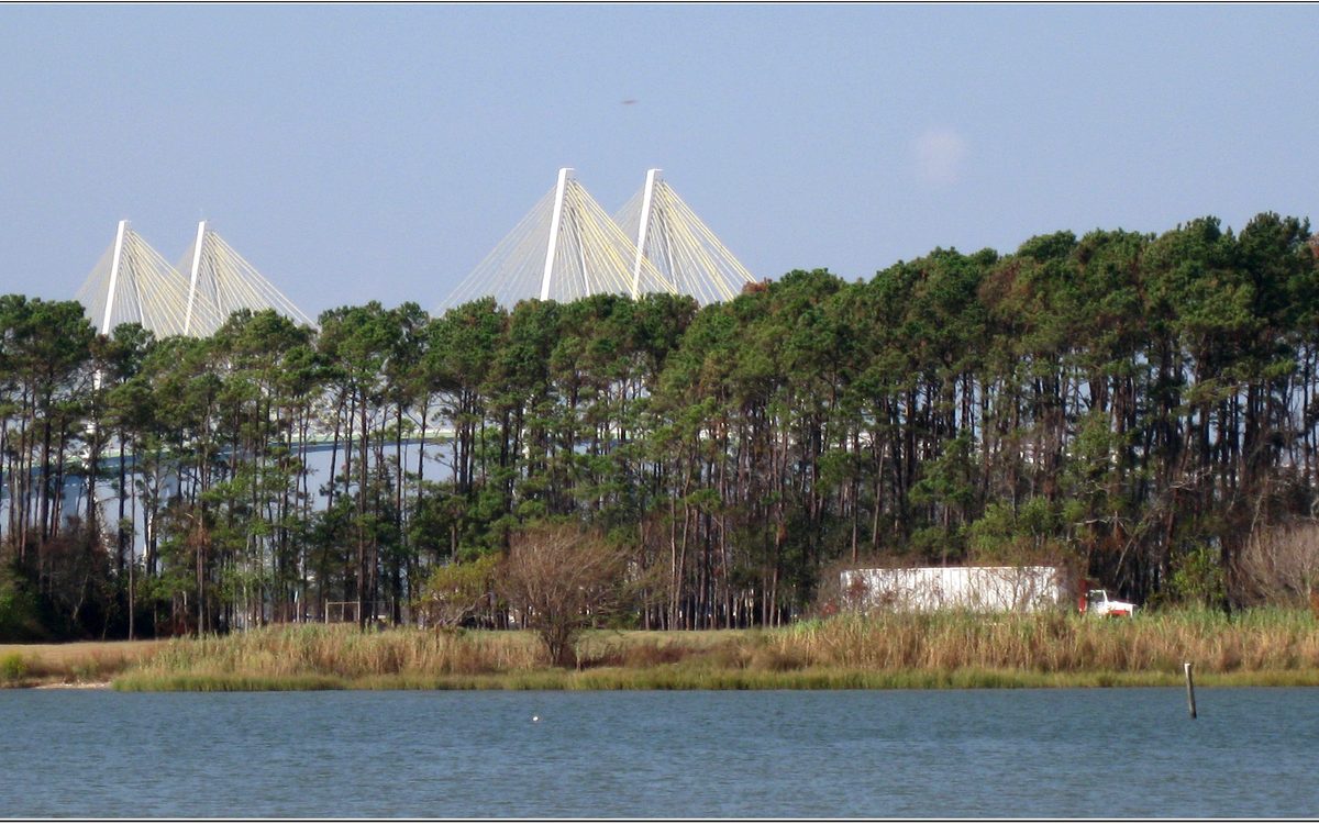
Hurricane season opens on June 1 under a quiet sky, and the bay's long memory of surge is why Baytown families spend ten minutes that day counting water and checking tanks.
On the first of June nothing happens. The day hurricane season opens, the bay looks exactly as it did on the last day of May, flat and brown-green under a white sky, the pier at Bayland Park sticking out into it with two men fishing off the end and a pelican on the rail. The weather people say the season has started. The water does not seem to have heard.
But somewhere in a kitchen in town someone is doing the thing they do on the first of June. Counting the cases of water in the garage. Checking the generator, or checking whether the generator would start if they had one. Filling the tank in the truck. Looking at the hurricane tracking map, the paper one from the newspaper or the utility bill or a printout from the National Hurricane Center's site, and pinning it on the refrigerator over the old one. It is a small ritual, ten minutes long, and it is done without much thought, and I have come to think it is one of the most serious things people here do.
The step that belongs on that list, if it is not already there, is finding out which evacuation zone your address is in: the emergency management offices of Harris County and Chambers County both publish lookups by address, and the National Hurricane Center's storm surge maps show how far the water can reach where you live. More in Hurricane season, the honest version.
Six months. June through November, with the worst of it in late August and September, when the Gulf has spent all summer soaking up sun and is as warm as bathwater to a depth that matters. A hurricane is a heat engine. It runs on warm water. The air over the Gulf picks up moisture, rises, and gives back the heat when the water vapor turns into cloud, and that heat drives more rising, which pulls in more air along the surface, which picks up more moisture. Given a few days and nothing to stop it, the engine tightens, spins, and walks. The depth matters because a storm churns the sea under it as it goes, and if the warm water is only a thin skin over cold, the storm brings the cold up and starves itself. Late in the summer the warm layer in the Gulf goes down far enough that there is nothing to bring up. The engine goes where the winds aloft steer it. Sometimes that is here.
The head of Galveston Bay

Baytown does not sit on the open Gulf. It sits at the upper end of Galveston Bay, tucked in behind Galveston Island and the Bolivar Peninsula, at the top of a body of water that is, for the most part, very shallow. People who do not live here might think that is protection. In some ways it is — the big waves break on the outer beaches. But shallow water has a memory of its own, and what it remembers is surge.
Storm surge is not a wave. It is the sea itself being lifted and pushed. Under the low pressure at the center of a hurricane the water bulges up a little, like the surface of a drink rising in a straw when you pull on it. That part is small. The big part is the wind. A hurricane's winds, blowing for hours across miles of open water, shove the surface of the sea ahead of them, and when that moving water meets a coast it has nowhere to go but up and in. On a steep coast with deep water offshore the surge stays modest, because the pushed water can sink and spread. On a shallow coast the pushed water cannot go down. It piles. And a bay, narrowing toward its head, is a funnel: water forced in at the mouth has less and less room the farther it goes, and it rises to make up the difference.
Baytown is at the head of Galveston Bay. There is no arguing with the geometry and no moving it. It was true long before there was a town here and it will be true after.
The bay remembers 1900, when the storm that destroyed Galveston came across the island and killed more people than any other natural disaster in the country's history. The bay remembers 1983, when Alicia came in over the bay and finished the Brownwood subdivision — a neighborhood that had already been sinking for years as groundwater was pumped from beneath it, flooding a little worse each time, until the surge went through the houses and the town decided to let it go. The land is the Nature Center now. You can walk on it, the trails and the ponds, and here and there the path is said to follow what was once a street, so that you are walking where somebody's driveway was.
The bay remembers September 2008, when Ike came up the coast and pushed the water into the upper bay in the dark, and the sun came up on a shoreline that had moved. And August 2017, when Harvey did not come in as surge at all but sat down over the region and rained — more than fifty inches at some gauges in the Houston area, a number that had not been in anyone's plan — and the water came from the sky and from the bayous and from the rivers behind the town, all at once. Different storms, different water. The same bay took it all.
Written into the shoreline

The bay's memory is the record itself. Every one of those storms is written into the shape of the shoreline, the height of the marsh, where the salt grass grows and where the trees died. The people who lived through them have their own memories, and those are sharper and shorter. A person remembers the sound of the wind, the smell of the house afterward, the night without power when the whole street sat outside because it was cooler out there. A person remembers the neighbor with the boat. A person remembers what they lost. But a person's memory fades in a decade or two, and the town's memory fades a little faster than that as people move in who were not here for it. The bay does not forget anything. It just waits.
That is why I think the ten-minute ritual on the first of June is serious. It is a way of matching your memory to the bay's. It is saying: I know where I live. I know what the water can do and I know it has done it. A case of water in the garage, a full tank, a plan for where the family goes and what they take — that is respect, not fear. You would not walk up to an animal that size without knowing what it was. You would not live beside one and pretend it was a pond.
The plants on the channel know this better than anyone, because they have to. A refinery cannot be evacuated the way a house can. Shutting a unit down safely takes time and is done in stages — the feed cut back, the heat taken off, the pressure let down, the lines cleared — and starting it back up takes longer than shutting it down did. The people who run those plants watch the same forecast the rest of us do and make their decisions days out, before the town does, because they have to be finished when the wind arrives. The night-shift operator on the tower has a view of the bay the rest of us do not get, and I have heard it said that from up there, before a storm, the water looks wrong first — the color changes, the swell comes in from the wrong direction, the birds go quiet — long before the first band of rain. I cannot verify that. I believe it.
A town's memory

What the town has learned, storm by storm, is written in things you can see if you know to look. Houses on the low streets rebuilt up on piers, their living rooms lifted a story into the air. Roads raised. The way a neighborhood simply stopped being a neighborhood and became marsh, on purpose, with a walking trail through it. The way people talk about Ike and Harvey by their first names, like relatives who visited once and left a mark on the house. The way the plywood at the hardware store sells out the afternoon the cone shifts west. None of that is in a manual. It is a town's memory doing its best to be as long as the bay's.
And the bay, for its part, gives back most of the year. It gives the sea breeze in the afternoon that makes August survivable. It gives the fishing off the pier and the pelicans on the rail. It gives the ships their road in and out — the whole reason the town has work at all is that the channel was dug through this water and opened in 1914, so that oceangoing hulls could reach Houston. The town is on the bay because the bay is useful, and the bay is dangerous for the same reason it is useful: it is big, it is joined to the Gulf, and it does what the weather tells it to.
So: the first of June. The pier, the pelican, the two men fishing. The map on the refrigerator with the tracks of old storms drawn on it in pencil. The water flat and quiet and not looking like it has ever done anything to anyone. You stand at the end of the pier and you look south, past the bridge, past where the channel goes out of sight, toward Galveston and the Gulf beyond it, and you think: not today. Not this week. Probably not this season. But the bay is not answering that question. It is not a question the bay has ever answered. It is only lying there, warm, remembering.
Read next: Hurricane season, the honest version, The Bayway side.
En español
Lo que recuerda la bahía
El primero de junio no pasa nada. El día en que abre la temporada de huracanes, la bahía se ve exactamente igual que el último día de mayo, plana y de un verde pardo bajo un cielo blanco, con el muelle de Bayland Park metido en ella, dos hombres pescando en la punta y un pelícano en la baranda. Los meteorólogos dicen que la temporada empezó. El agua parece no haberse enterado.
Pero en alguna cocina del pueblo alguien hace lo que se hace el primero de junio. Cuenta las cajas de agua del garaje. Revisa el generador, o revisa si el generador arrancaría si lo tuviera. Llena el tanque de la camioneta. Mira el mapa de seguimiento de huracanes, el de papel que regalan con el periódico o con la factura de la luz, o el que se imprimió del sitio del Centro Nacional de Huracanes, y lo prende al refrigerador encima del viejo. Es un ritual pequeño, de diez minutos, que se hace sin pensar mucho, y he llegado a creer que es una de las cosas más serias que hace la gente de aquí.
El paso que debería estar en esa lista, si todavía no lo está, es averiguar en qué zona de evacuación queda su domicilio: las oficinas de manejo de emergencias de los condados de Harris y de Chambers publican consultas por dirección, y los mapas de marejada ciclónica del Centro Nacional de Huracanes muestran hasta dónde puede llegar el agua donde usted vive. Más sobre eso en Hurricane season, the honest version.
Seis meses. De junio a noviembre, con lo peor a fines de agosto y en septiembre, cuando el Golfo ha pasado todo el verano absorbiendo sol y está tibio como agua de baño a una profundidad que importa. Un huracán es un motor de calor. Funciona con agua caliente. El aire sobre el Golfo recoge humedad, sube, y devuelve el calor cuando el vapor se vuelve nube, y ese calor impulsa más ascenso, que atrae más aire por la superficie, que recoge más humedad. Con unos días y nada que lo frene, el motor se aprieta, gira y avanza. La profundidad importa porque una tormenta revuelve el mar bajo ella a su paso, y si el agua cálida es solo una película delgada sobre agua fría, la tormenta sube el frío y se quita su propio alimento. A fines del verano la capa cálida del Golfo baja tanto que no hay nada que subir. El motor va adonde lo guían los vientos en altura. A veces es aquí.
La cabecera de la bahía de Galveston
Baytown no queda sobre el Golfo abierto. Queda en el extremo superior de la bahía de Galveston, resguardado detrás de la isla de Galveston y de la península de Bolivar, en lo alto de una masa de agua que es, en su mayor parte, muy poco profunda. Quien no vive aquí podría pensar que eso protege. En algunos sentidos sí: las olas grandes rompen en las playas exteriores. Pero el agua somera tiene su propia memoria, y lo que recuerda es la marejada.
La marejada ciclónica no es una ola. Es el mar mismo, levantado y empujado. Bajo la presión baja del centro de un huracán el agua se abomba un poco, como sube el líquido de una bebida por un popote cuando se aspira. Esa parte es pequeña. La parte grande es el viento. Los vientos de un huracán, soplando durante horas sobre millas de agua abierta, empujan la superficie del mar por delante, y cuando esa agua en movimiento llega a una costa no le queda más que subir y entrar. En una costa empinada, con agua profunda mar adentro, la marejada se mantiene modesta, porque el agua empujada puede hundirse y esparcirse. En una costa somera el agua empujada no puede bajar. Se amontona. Y una bahía que se angosta hacia su cabecera es un embudo: el agua que entra por la boca tiene cada vez menos espacio mientras avanza, y sube para compensar la diferencia.
Baytown está en la cabecera de la bahía de Galveston. No hay discusión posible con la geometría, ni manera de moverla. Era cierto mucho antes de que hubiera un pueblo aquí y lo seguirá siendo después.
La bahía recuerda 1900, cuando la tormenta que destruyó Galveston cruzó la isla y mató a más gente que cualquier otro desastre natural en la historia del país. Recuerda 1983, cuando Alicia entró sobre la bahía y acabó con el fraccionamiento de Brownwood, un barrio que ya llevaba años hundiéndose porque se bombeaba agua subterránea debajo de él, y se inundaba un poco peor cada vez, hasta que la marejada atravesó las casas y el pueblo decidió dejarlo ir. Hoy ese terreno es el Centro de la Naturaleza. Se puede caminar por los senderos y las lagunas, y aquí y allá se dice que el camino sigue lo que fue una calle, de modo que uno pisa donde estuvo el acceso de la casa de alguien.
La bahía recuerda septiembre de 2008, cuando Ike subió por la costa y empujó el agua hacia la parte alta de la bahía en la oscuridad, y el sol salió sobre una orilla que se había movido. Y agosto de 2017, cuando Harvey no llegó como marejada sino que se sentó sobre la región y llovió, más de cincuenta pulgadas en algunos medidores del área de Houston, una cifra que no estaba en el plan de nadie, y el agua vino del cielo y de los bayous y de los ríos detrás del pueblo, todo a la vez. Tormentas distintas, agua distinta. La misma bahía lo recibió todo.
Escrito en la orilla
La memoria de la bahía es el registro mismo. Cada una de esas tormentas está escrita en la forma de la costa, en la altura del pantano, en dónde crece el pasto salado y dónde murieron los árboles. Quienes las vivieron tienen su propia memoria, más aguda y más corta. Uno recuerda el sonido del viento, el olor de la casa después, la noche sin luz en que toda la calle se sentó afuera porque se estaba más fresco. Uno recuerda al vecino de la lancha. Uno recuerda lo que perdió. Pero la memoria de una persona se apaga en una década o dos, y la del pueblo se apaga un poco más rápido, porque llega gente que no estuvo aquí. La bahía no olvida nada. Solo espera.
Por eso creo que el ritual de diez minutos del primero de junio es serio. Es una manera de igualar su memoria con la de la bahía. Es decir: sé dónde vivo. Sé lo que puede hacer el agua y sé que lo ha hecho. Una caja de agua en el garaje, un tanque lleno, un plan de adónde va la familia y qué se lleva: eso es respeto, no miedo. Uno no se acercaría a un animal de ese tamaño sin saber qué es. Uno no viviría junto a él fingiendo que es un estanque.
Las plantas del canal lo saben mejor que nadie, porque tienen que saberlo. Una refinería no se puede evacuar como una casa. Apagar una unidad con seguridad lleva tiempo y se hace por etapas, con la carga reducida, el calor retirado, la presión liberada y las líneas despejadas, y volver a arrancarla lleva más tiempo que apagarla. Quienes operan esas plantas miran el mismo pronóstico que todos y toman sus decisiones con días de anticipación, antes que el pueblo, porque tienen que haber terminado cuando llegue el viento. El operador del turno de noche en la torre tiene una vista de la bahía que los demás no tenemos, y he oído decir que desde allá arriba, antes de una tormenta, el agua se ve mal primero: cambia el color, el oleaje llega de la dirección equivocada, las aves se callan, mucho antes de la primera banda de lluvia. No puedo comprobarlo. Lo creo.
La memoria de un pueblo
Lo que el pueblo ha aprendido, tormenta tras tormenta, está escrito en cosas que se ven si uno sabe mirar. Casas de las calles bajas reconstruidas sobre pilotes, con la sala elevada un piso en el aire. Caminos levantados. La manera en que un barrio dejó de ser barrio y se volvió pantano, a propósito, con un sendero para caminar. La manera en que la gente habla de Ike y de Harvey por su nombre de pila, como parientes que visitaron una vez y dejaron huella en la casa. La manera en que la madera contrachapada de la ferretería se agota la tarde en que el cono se mueve al oeste. Nada de eso está en un manual. Es la memoria de un pueblo haciendo lo posible por ser tan larga como la de la bahía.
Y la bahía, por su parte, da la mayor parte del año. Da la brisa marina de la tarde que hace soportable agosto. Da la pesca desde el muelle y los pelícanos en la baranda. Da a los barcos su camino de entrada y salida: la razón entera por la que el pueblo tiene trabajo es que el canal se abrió a través de estas aguas en 1914, para que los cascos de altamar pudieran llegar a Houston. El pueblo está en la bahía porque la bahía es útil, y la bahía es peligrosa por la misma razón por la que es útil: es grande, está unida al Golfo y hace lo que el clima le dicta.
Así que: el primero de junio. El muelle, el pelícano, los dos hombres pescando. El mapa en el refrigerador con las trayectorias de tormentas viejas dibujadas a lápiz. El agua plana y callada, sin aspecto de haberle hecho nunca nada a nadie. Usted se para en la punta del muelle y mira hacia el sur, más allá del puente, más allá de donde el canal se pierde de vista, hacia Galveston y el Golfo detrás, y piensa: hoy no. Esta semana no. Probablemente esta temporada no. Pero la bahía no responde esa pregunta. Es una pregunta que nunca ha respondido. Solo está ahí tendida, tibia, recordando.
Lea también: Hurricane season, the honest version, The Bayway side.